Also, the study shows that people who live in neighborhoods with a mix of shops and businesses within easy walking distance are 7 percent less likely to be obese, lowering their relative risk of obesity by 35 percent.
The $4 million, seven-year study, Strategies for Metropolitan Atlanta’s Regional Transportation and Air Quality (SMARTRAQ), also reveals that higher levels of land-use mix, residential density, employer density and street connectivity are associated with:
- fewer vehicles miles traveled.
- reduced emissions contributing to air pollution.
- greater use of public transit.
- increased physical activity.
“The effect of urban form on travel behavior and health is one of the unique aspects of the project,” observed James Chapman, SMARTRAQ co-director and a researcher in the Georgia Tech Research Institute, where the project resides. “How we plan and build our communities not only affects air pollution and how much we drive, but also people’s likelihood of being physically inactive and obese.”
SMARTRAQ, which is unusual in both size and scope, takes a holistic approach to land use, transportation and health issues.
It is the first study to demonstrate that the built environment immediately around people’s homes is a good predictor of how much they weigh, says co-director and lead author Lawrence Frank. Now a professor at the University of British Columbia, Frank spearheaded SMARTRAQ in 1997 when he was an assistant professor of city planning at Georgia Tech.
“Density and street connectivity also matter, but mixed use is the most important factor relating to physical activity and obesity,” Frank said. “People need destinations to walk to.” But Frank also notes that density is required to create the demand for local retailers and other commercial activities to survive.
Number Crunching
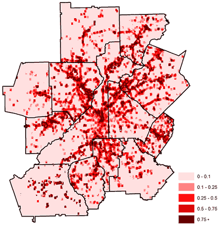
When researchers started SMARTRAQ, one of their challenges was to create a detailed database of land use for the 13-county metro Atlanta region.
Some of the required information was available from county tax assessors, but each county categorized its data differently, which made compilation a considerable task. Yet once completed, the SMARTRAQ database provided researchers with a new tool to analyze travel behavior.
“Typically, trip generation is predicted solely from vehicle ownership, household income and household size,” Chapman explained. “Yet the parcel-based SMARTRAQ database gives us an unprecedented depth of information, such as the square footage of buildings, density of the surrounding neighborhood and how close homes are to commercial buildings or stores.”
The database then was used to help analyze information collected in a large-scale activity survey. Conducted in 2001 and 2002, this survey studied 8,000 Atlanta-area households – with special efforts to include low-income and minority groups often underrepresented in studies.
Researchers wanted to know how people spent their time, where they traveled and how they reached those destinations. In addition to subjective travel diaries, researchers used global positioning systems and accelerometers worn by people to collect objective measurements.
One portion of the survey focused on community preference. Researchers asked participants to choose between two neighborhoods (assuming that school quality, cost and safety were equal):
- A typical suburban setting where residents are dependent on cars for transportation and houses are spaced farther apart.
- A “smart growth” neighborhood where stores and restaurants lie within walking distance, train and bus stations are nearby and housing is a mix of single-family homes, townhouses and apartment buildings.
The verdict: Approximately one-third of respondents who live in the typical suburban setting said they would prefer to live in a smart-growth environment. Although this may be a minority, it remains a significant response, researchers say.
“SMARTRAQ shows there is an unmet demand for smart-growth neighborhoods,” Frank explained. “Atlanta’s development industry is known for churning out sprawl, and critics might argue that this is what people want because that’s what they’re buying. But they’re buying it because they don’t have many other choices.”
SMARTRAQ in Action
Completed this spring, the SMARTRAQ study will help a variety of organizations improve their decisions and policies on transportation, environmental and land-development issues, the researchers predict.
Underscoring its broad applications, SMARTRAQ’s sponsors and partners include: the Georgia Department of Transportation, Federal Highway Administration, Georgia Regional Transportation Authority, Atlanta Regional Commission (ARC), U.S. Environmental Protection Agency, Turner Foundation, U.S. Centers for Disease Control and Prevention, Metro Atlanta Chamber of Commerce and the Urban Land Institute.
ARC is already using SMARTRAQ data to update its travel-demand models and long-range transportation plan. What’s more, SMARTRAQ evaluated participants in ARC’s Livable Centers Initiative (LCI), a program that provides seed money to communities that are enhancing sidewalks and streetscapes, improving access to public transportation and expanding housing options.
“SMARTRAQ determined that the LCI plans would, indeed, result in fewer vehicle miles traveled and reduced emissions, which were exactly the results we hoped for,” said Tom Weyandt, ARC’s director of comprehensive planning.
“Because LCI is a new approach, there have been some skeptics,” Weyandt added. “Yet the SMARTRAQ data demonstrates that if we develop these planning processes, and if local communities take them seriously, we can make a measurable improvement in our transportation systems and air quality through community-based land-use strategies.”
 A new trial investigates whether the MIND diet can be scaled for obesity management